Saturday, July 10, 2010

Haines


We arrived in Skagway on the same day that three cruise ships docked, so we decided to skip this "tourist town" and catch the earliest Alaska Marine Highway ferry over to Haines.  Haines is only 15 miles from Skagway by water, but it is 359 miles by road! Gas was costing about $3.50 per gallon, so we decided that the ferry fare of $151.00 for both of us and the RV was a good deal.                                  
                                                                           

Our Lazy Daze group had planned to stay at The Oceanview RV Park so we pulled in there, and when we found out they were full we bartered for spot where we could dry camp. We ended up perched on the back of the parking lot, on the very edge of Portage Cove. It felt a little precarious, but the view was to die for so we stayed.


The days we were in Haines were overcast and rainy but we stayed because we had good internet connections for the first time in nearly two weeks.  We took the opportunity to hunker down in the RV and catch up on our e-mails and our Blogs. 


We went for walks into town for exercise and to get the feel of this laid back community.  The first day we were amazed to see people wearing tank tops in the 52 degree weather.  I guess if it is June, you figure it must be summer. I was also impressed by the bright flowers planted throughout the town and the vibrant hanging baskets.


One day we stopped by the Chilkat Bakery for some hot coffee and a treat, and discovered that the business was owned by a Thai woman who came here from Portland, Oregon.  Small world!


The Milepost explained that the original Indian name for Haines was Die-Shu, meaning "end of the trail".  The name refers to where Chilkat and Chilkoot Indians met and traded with Russian and American ships here, at the end of the Kenai Peninsula. Fishing and gold mining were the initial industries of the early settlers, and now Haines is the gateway to the Alaska Highway for inside passage travellers, and caters to tourists passing through.

One of the big attractions is The Alaska Chilkat Bald Eagle Preserve, just north of Homer.  From mid-October through December, 3,500 bald eagles gather there for the late run of salmon.  In 1982 a 48,000 acre preserve was established to protect this habitat.  Unfortunately, we were there at the wrong time of year to see that. However, we pulled out at one of the many wayside areas to look at the Chilkat River and check with our binoculars just in case there was an "early bird" around.


In some places, like Whitehorse and Dyea, I had wanted to get right in the middle of them and feel them. Looking back I realize that I just floated through Haines without really being touched by it. Maybe the weather had something to do with it, or maybe I was just ready for some down-time. 

Dyea, a Disappearing Town


When we stopped and camped in Dyea, (pronounced dye-EE) I finally started getting a grasp of the craziness of the gold rush era.  Gold was first discovered in California in 1849. Then the shout went out from Alaska. That started the Klondike gold rush of 1897-1898 and captured the imagination of the world.  People from all over travelled to Alaska and scrambled however they could to be one of the lucky ones to get there fast and stake their claim. The Park Rangers at Dyea told us that less than 1% of the miners struck it rich. The people who profitted were those who sold the supplies and services to the miners. 

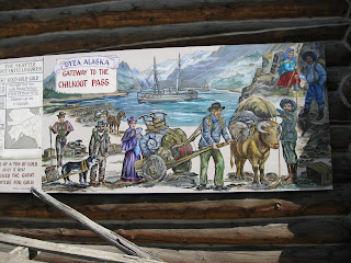
A mural in Whitehorse

The Chilkoot Trail was the shortest and the best known route to the Klondike.  There is a photograph of an endless line of stampeders struggling over the Chilkoot Pass in the dead of winter in 1897-98. That image represents the powerful drive of the dream of finding gold and getting rich.  Some prospectors travelled up the Fraser Valley, others took ships right into the Taiya Inlet at Skaway and from there they hiked the Chilkoot Pass over to Lake Bennett and routes north.

A mural from the MacBride Museum in Whitehorse

In 1897 Dyea, the small settlement of native packers and a trading post, suddenly became a city.  It was the gateway to the Chilkoot Pass that gave prospectors a shortcut to the Klondike gold fields.  Tents and shacks, outfitting stores, restaurants, hotels and saloons crowded the river plain.  At one point over 150 businesses offered services to the stampeders.  By the spring of 1898 Dyea's population had swelled to a transient population of as many as 10,000.  Dyea made the national headlines!

Common Horsetails

Now it is hard to even imagine there ever was a town here, along the tidal flats of Taiya Inlet. From the road driving into the campsite we could see a few rows of rotting wharf pilings.  There is a small graveyard called "Slide Cemetery" which holds the bodies of 70 men killed in a snow avalanche on the Chilkoot Pass, and there are a few remains of buildings and depressions in the ground that indicate where the town once stood.  One of the kiosks along the walking tour notes the "Dyea's growth and demise was abrupt as the gold rush itself.  When the White Pass and Yukon Route Railway opened in 1898, that linked Skagway and Lake Bennett, Dyea began to fade.  Most of the buildings were torn down and the lumber was hauled away."


Today only the trail over Chilkoot Pass remains basically as it was.  I was touched by the vibrant history of Dyea, and could almost feel the frantic energy of the gold rush days. David and I decided to hike the first part of the trail just to experience how it may have felt.  Of course we were doing it on a sunny day in June and not in the middle of winter, but we still got to walk the trail and let our imaginations fly.


The trail is very steep at the beginning.  This section is known as "Saintly Hill" because anyone who can climb it without swearing would be considered a saint.


After the initial part, the trail got easier, and sometimes almost felt like a walk in the park.


There was one long section of boardwalk that crossed many beaver ponds.


After that we began seeing bits of trash along the trail that were left behind by the prospectors. I couldn't help but wonder how the men made the climb in the middle of the winter.  By law the would-be-miners had to carry in one ton of supplies to prevent their starvation once they got to the Yukon.  That meant that they had to hike the Chilkoot Pass up to twenty times before they could push on.


David and I put in a long day of hiking and never even reached the first established camp at Finnigan's Landing.  However, we had great fun. And, you can bet I was one happy camper to finally get back to the RV!

Dwarf Dogwood, Bunchberry

By 1903, less than five years later, the population of Dyea had fallen to only three people. Since the rush, nature has reclaimed the land and since 1978 the Chilkoot Trail and the Dyea Townsite have been designated a National Historic Landmark to ensure that this area is preserved for future generations.

There is not much to "see" in Dyea, but what I "felt" is difficult to put into words.  I hold the knowledge of the frantic energy and futile struggles of thousands of men on one hand, and how this discovery of gold was such an invasion of the traditional territory of an indigenous population on the other.

And now, Mother Nature has reclaimed it all. 

Thursday, July 8, 2010

South on the Klondike Highway


From Whitehorse we took the Klondike Highway south toward Skagway.  We stopped at a rest area overlooking Emerald Lake. 


All the mountains surrounding the lake are made up of limestone which was created by reef building corals growing in a warm sea 150-200 million years ago.  The calcium carbonate in the limestone reacts with the carbon in the water, and over the years it has produced marl which is like white clay that settles on the bottom of the lake.  When the sun reflects off the marl it makes the water look emerald in color. 

Over the years as the water level gradually rose, the coral built upon itself, growing toward the light and thus creating high mountains of limestone.  As I sood at the information kiosk and tried to fathom 200 million years, and accept that there was once coral growing in a warm sea right where I was standing, I was in awe.


The sounds of a bus lured me away from my deep thoughts.  Not one but six tour buses arrived while we were standing there.  These were excursion buses bringing people from cruise ships anchored in Skagway.  Very few people took the time to read about what they were photographing.  In five minutes they were loaded back on the buses and were gone.  Thank heavens we have the luxury of time.


While I was taking it all in, I started talking to a woman standing next to a pickup truck.  Come to find out, she and her husband were the camp hosts at Dyea Campground (pronounced dye-E), at the trailhead to the Chilkoot Pass. I had been thinking about camping at Dyea and wanting to see the famous Chilkoot Trail, but David was reluctant to go there because it meant driving seven miles on gravel road. Judy reassured us that we could take the RV there without any problem.  So I told David that meeting Judy and her husband Jim was an good omen, and that should be our night's destination.  As they say, "there are no accidents!"


Our next stop was Carcross, which is a First Nation village.  It was originally called Carabou Crossing but the name was changed because so many other places in the northwest had that name and often addresses were confused and mail delayed. 

Situated on the shore of Lake Bennett, at one time Carcross was a stopping place for miners on their way to the gold fields.  From 1900-1982 it was a major stop for the White Pass & Yukon Route Railroad. In those early days passengers and freight were transferred from rail to sternwheelers like the Klondike


The Visitors' Center is housed in the old railway station.  From there David and I took the Carcross walking tour through town. There are only 399 people living there now, but it is a fascinating place to visit. There are many small cabins along the lake front which used to be considered squatters huts.  However, they are now recognized as historical homes.


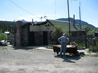
We stopped and chatted with folks we met along the way, like Susan who had a card table set up to sell her handmade jewelry.  She emigrated here from Mexico eight years ago with her infant son.  She lives in a little cabin just outside of town and has no electricity and no running water.  She told us stories about how she has to chop a hole in the ice and get water from the lake in the winter. Nevertheless she loves living here and raising her son here.  Susan told us she feels very welcomed by the Native population.


We met Dee, the postmistress and her dog Louie.  Dee used to have a garden here, but she said that things grow  like mad in the midnight sun and it is difficult to keep up with the work.  There was a five foot rhubarb plant next to the post office that confirmed her claim.

Dee told us that her husband hunts and fishes to provide food for them.  He shoots one moose and one bison each year.  She claims that the bison is heavier than the moose but has less meat because of the size of its bones and the thickness of its hair. I guess one learns these things if there is no supermarket in the neighborhood.

Further along the road we met Bill, who was soaking up the sun in his yard.  He came here from the Netherlands over 45 years ago.  He said he never looked back.  His house was one that was taken from Conrad after the mines there "dried up".  The house was transported over the frozen lake in mid-winter.  He paid the original owner about $89,000 for the house and he thinks he could sell it today for at least $250,000.  He let us walk around to the back of his house and see his view of Lake Bennett.  That alone is worth the money!


Carcross was delightful, and we had a hard time leaving.  However we knew we had to drive over the White Pass summit (3,292 feet) and get over the Alaska border before the end of the day. As we drove higher we came to an area that David identified as Canadian shield.  It is made up of pre-Cambrian rock.  It actually felt  prehistoric to me.  The rocks were sharp with many outcroppings. It was icy with large patches of snow and many small ponds for as far as we culd see.  All the vegetation was stunted.  In several areas people had placed cairns.  Some were piled up to look like the Native's inukshuk, erected to help people find their way in the high tundra.


Finally we reached the White Pass Summit and the Alaskan border.  From that point it was all downhill.  Down and down at an 11% grade!  As we descended we could look across the valley and see the railway tracks and tressels of the White Pass and Yukon Route Railway. 

Down we went, into the Skagway Valley and a new chapter in our adventure.

Building on the Past, Looking to the Future


David and I decided to stay in Whitehorse one more day.  We had not visited The McBride Museum of Yukon History and we really wanted to do that before we left.  Since we had shopping to do we moved over to the Walmart parking lot.  We restocked our supplies and made plans for the next day. That night we were surrounded by at least 30 other RV's.  Everyone was loading up with supplies.  It reminded me of the craze of the gold rush days as people pushed loaded grocery carts to their rigs.


That night we had a hard time falling asleep because of the incessant cries of sea gulls. They did not let up their racket until midnight, when it finally got dark.  The next morning we decided to walk the river trail just opposite Walmart.  Not far up the path we learned from an information marker that the islands there were probably the biggest colony of Mew Gulls in the Yukon Territory. Apparently the birds flock to this place to escape the treat of predators inland, and to take advantage of the plentiful food supply in the river. When we saw the birds flhying all over the island we realized why it was such a noisy night!


Taking the path in the other direction led us back to town.  Whitehorse has many small parks and we found this sculpture in one of the parks next to the river.  The plaque near it named it "Building on the Past, Looking to the Future". It was created by Ken Anderson in 2002.  It reflects the currant efforts to bring all the people of the Yukon together as one people and recognize the history and the contributions of the First  Nation People


David and I decided that Whitehorse is a young people's town.  We have never seen so many canoes and kayaks and bikes as were here. The coffee shops were full of young people chatting, or busy on their computers or i-pods. There is a Starbucks in town, but it gets local competition from cafes like Baked.


After our lunch we wandered through The Pioneer Cemetary taking note of the grave markers of people who hailed from such far off places as Dublin, Ireland and Edinburgh, Scotland.  Emil Forrest seems to have been born here. 


We spent a couple hours at the MacBride Museum of Yukon History.  It is a wonderful place to get a glimpse into every part of the Yukon's history.  Of course, when I heard they had Sam McGee's cabin I was eager to see it.
                           

Sam McGee was actually a resident of Whitehorse. Apparently Robert Service liked his name and so he used it in his famous poem "The Cremation of Sam McGee". I remember my father reading that poem to us children when we were young.  My dad loved to read the works of Robert Service and Jack London and he dreamed about travelling to Alaska someday.  Now I am living his dream.


In my opionion, the other real treasure in the museum is "The Champion Hair Picker".  That contraption was new to me.  It was used to card horse hair.  The horse hair arrived full of hay and dirt and was put through this machine to clean it.  The horse hair was then used as stuffing in the upholstry for seats of wagons and coaches and even house furniture. I had heard of horse hair stuffing but I never thought of the process it took to prepare it.


In a gift shop on Main Street I found some artificial Fireweed blossoms.  Fireweed is the official flower of the Yukon and by July it will have replaced the ever present dandelions we see along the roadways now.  I like this humble plant. Every part of it is edible. I like that. And I like its brilliant color which some people tell me is "my" color. I like that too.


White Horses on the Yukon River


Whitehorse is the capital of the Yukon Territory and was built on the west bank of the upper reaches of the mighty Yukon river.  The city is a wonderful mix of pioneer spirit and urban sophistication. Even the modern dweller has to have a little pioneer blood to withstand the winter temperatures which have hit a record -62 degrees! 


After getting settled in at The Hi Country RV Park, David and I walked into town.  We had to walk part of the way along the main highway into town, named "Robert Service Way". Then we took the paved walkway along the Yukon River. 


There are informational displays along the walkway which help bring the local history to life.  I learned that the Yukon River is 2000 miles long!  It flows northwest from its headwaters near the Yukon Territory-British Columbia border to the Bering Sea.  One source said that some 50,000 prospectors followed the Yukon River from Lake Bennett to Dawson City during the Klondike Gold Rush of 1898-1899.


For the most part, a skilled boatsman can navigate the Yukon River relatively easily. However, the river flows through Miles Canyon and there the turbulent waters and the rapids below proved to be the major obstacles on the river.  The foaming waves reminded early travelers of tossing horse manes, and hence the name White Horse Rapids, and later, Whitehorse City.


The river walkway ended up at the Klondike paddle wheeler.  This is one of the three sternwheelers left from the 250 that served travelers between 1860 until the mid 1950's. The Klondike was the largest of the paddlewheel steamers designed to carry more cargo up and down the Yukon.  Usually it made 10-14 trips each summer, and on its last trip upriver it brought winter supplies. The Klondike overwintered in Whitehorse with the other ships. They were frozen in by mid-October and stayed that way for seven months!


David and I wandered around town.  We visited a bookstore, took a picture of Starbucks, bought tickets for The Frantic Follies vaudeville show, and checked out the bus station so we could catch a ride back to the RV park after the show. It was fun to be in a busy town for awhile, and take in the sights.


For supper we went to The Klondike Rib and Salmon BBQ. It is such a popular restaurant that there are benches along two sides of the building where people can sit and wait for their names to be called. We split a dinner of baby back ribs and washed it down with some locally brewed Yukon Red beer....advertised as "the only beer worth freezing for". 


And, for desert we splurged on the house specialty, bumbleberry pie a' al mode.  Actually this seems to be a Yukon specialty that mixes together blackberries, raspberries, strawberries and rhubarb.  It's yummy.


We stayed in Whitehorse for five days so we both could get our Blogs set up on the computer.  That proved to be challenging for both of us.  However, it will add another dimension to our travels and we think it will enrich our experiences as we go along.

For another perspective on our travels check out David's Blog at:
                                        www.highwaytoadventure.blogspot.com