
From Whitehorse we took the Klondike Highway south toward Skagway. We stopped at a rest area overlooking Emerald Lake.

All the mountains surrounding the lake are made up of limestone which was created by reef building corals growing in a warm sea 150-200 million years ago. The calcium carbonate in the limestone reacts with the carbon in the water, and over the years it has produced marl which is like white clay that settles on the bottom of the lake. When the sun reflects off the marl it makes the water look emerald in color.
Over the years as the water level gradually rose, the coral built upon itself, growing toward the light and thus creating high mountains of limestone. As I sood at the information kiosk and tried to fathom 200 million years, and accept that there was once coral growing in a warm sea right where I was standing, I was in awe.

The sounds of a bus lured me away from my deep thoughts. Not one but six tour buses arrived while we were standing there. These were excursion buses bringing people from cruise ships anchored in Skagway. Very few people took the time to read about what they were photographing. In five minutes they were loaded back on the buses and were gone. Thank heavens we have the luxury of time.

While I was taking it all in, I started talking to a woman standing next to a pickup truck. Come to find out, she and her husband were the camp hosts at Dyea Campground (pronounced dye-E), at the trailhead to the Chilkoot Pass. I had been thinking about camping at Dyea and wanting to see the famous Chilkoot Trail, but David was reluctant to go there because it meant driving seven miles on gravel road. Judy reassured us that we could take the RV there without any problem. So I told David that meeting Judy and her husband Jim was an good omen, and that should be our night's destination. As they say, "there are no accidents!"

Our next stop was Carcross, which is a First Nation village. It was originally called Carabou Crossing but the name was changed because so many other places in the northwest had that name and often addresses were confused and mail delayed.
Situated on the shore of Lake Bennett, at one time Carcross was a stopping place for miners on their way to the gold fields. From 1900-1982 it was a major stop for the White Pass & Yukon Route Railroad. In those early days passengers and freight were transferred from rail to sternwheelers like the Klondike.
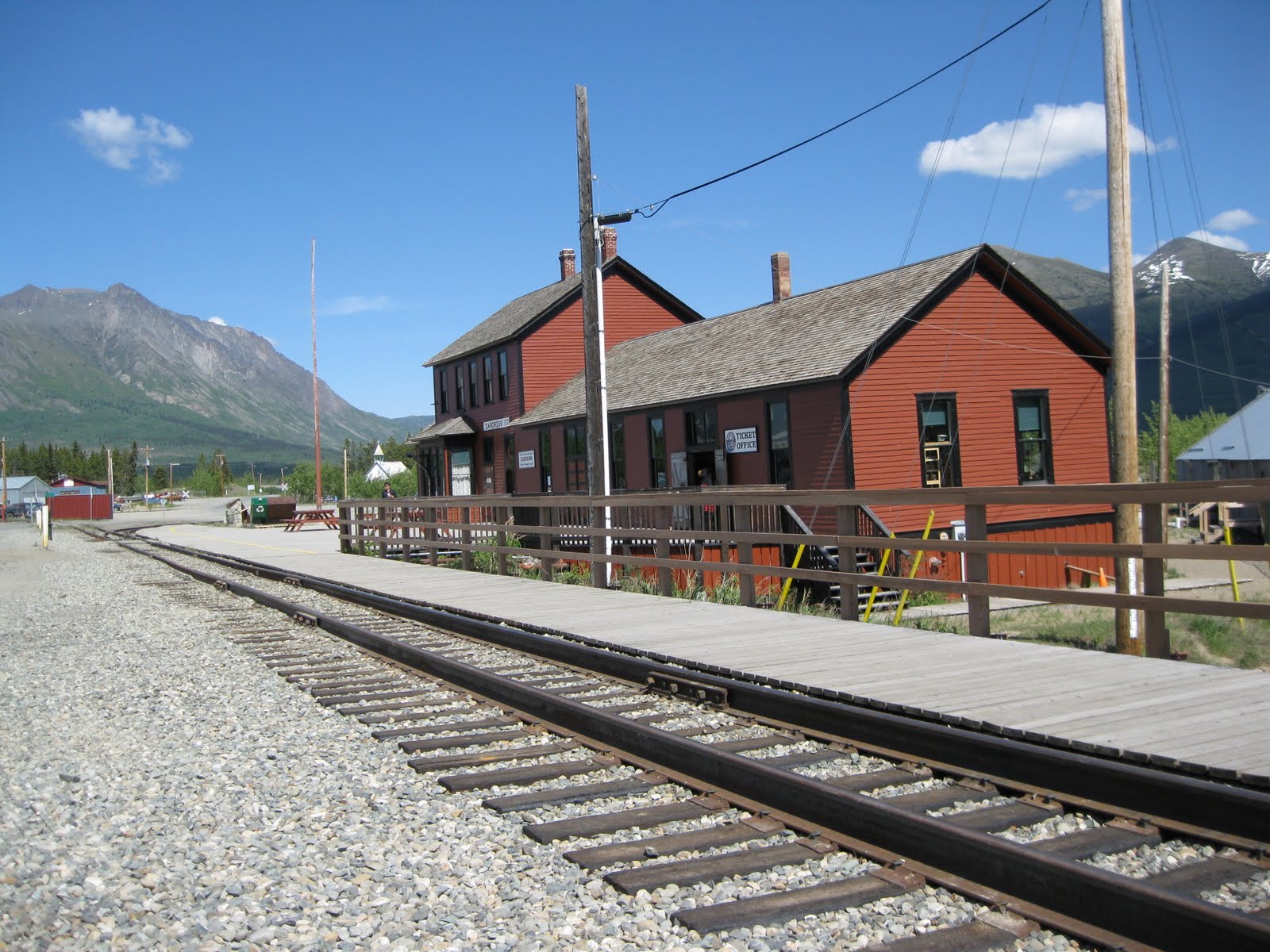
The Visitors' Center is housed in the old railway station. From there David and I took the Carcross walking tour through town. There are only 399 people living there now, but it is a fascinating place to visit. There are many small cabins along the lake front which used to be considered squatters huts. However, they are now recognized as historical homes.
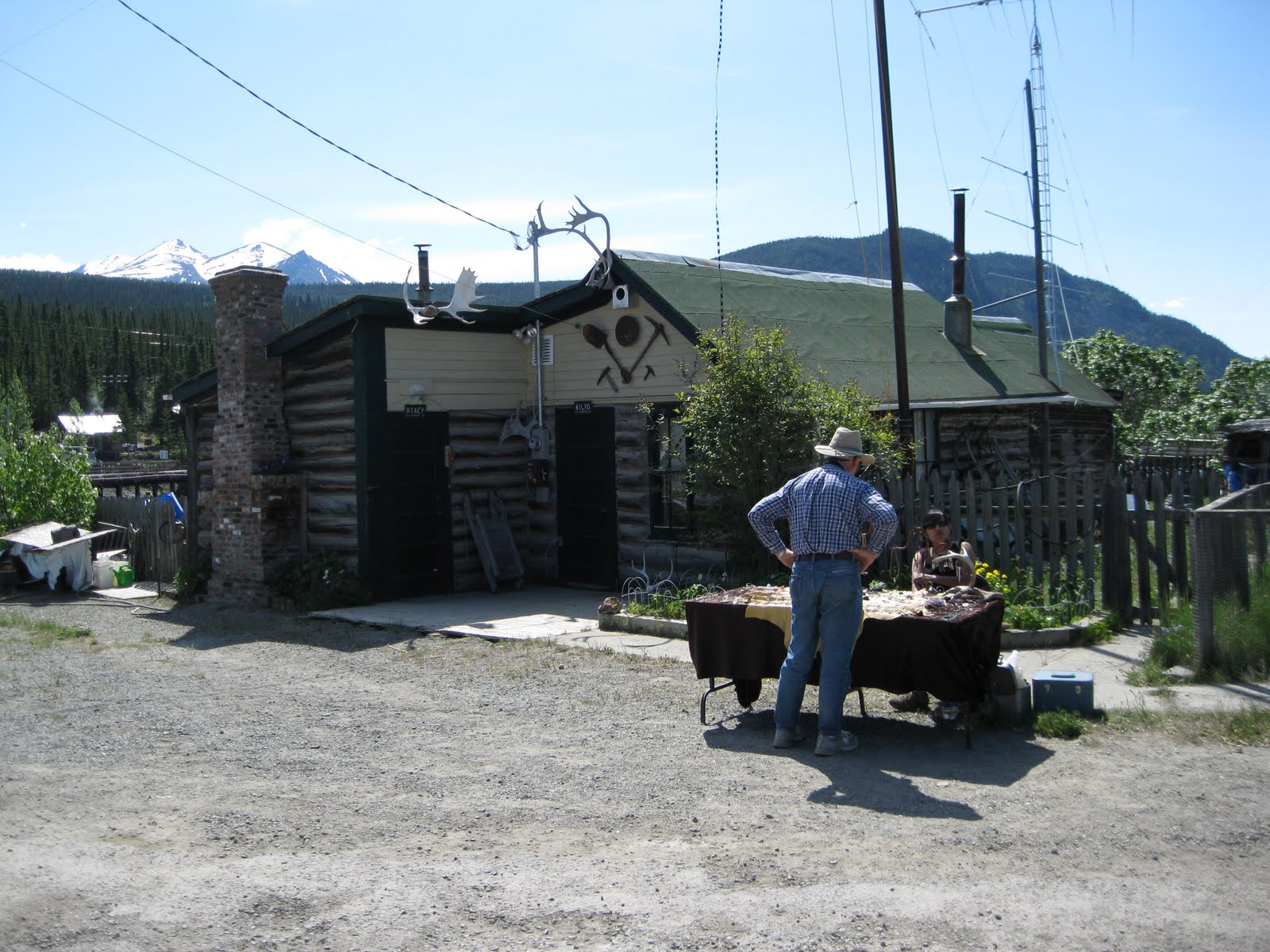

We stopped and chatted with folks we met along the way, like Susan who had a card table set up to sell her handmade jewelry. She emigrated here from Mexico eight years ago with her infant son. She lives in a little cabin just outside of town and has no electricity and no running water. She told us stories about how she has to chop a hole in the ice and get water from the lake in the winter. Nevertheless she loves living here and raising her son here. Susan told us she feels very welcomed by the Native population.

We met Dee, the postmistress and her dog Louie. Dee used to have a garden here, but she said that things grow like mad in the midnight sun and it is difficult to keep up with the work. There was a five foot rhubarb plant next to the post office that confirmed her claim.
Dee told us that her husband hunts and fishes to provide food for them. He shoots one moose and one bison each year. She claims that the bison is heavier than the moose but has less meat because of the size of its bones and the thickness of its hair. I guess one learns these things if there is no supermarket in the neighborhood.
Further along the road we met Bill, who was soaking up the sun in his yard. He came here from the Netherlands over 45 years ago. He said he never looked back. His house was one that was taken from Conrad after the mines there "dried up". The house was transported over the frozen lake in mid-winter. He paid the original owner about $89,000 for the house and he thinks he could sell it today for at least $250,000. He let us walk around to the back of his house and see his view of Lake Bennett. That alone is worth the money!

Carcross was delightful, and we had a hard time leaving. However we knew we had to drive over the White Pass summit (3,292 feet) and get over the Alaska border before the end of the day. As we drove higher we came to an area that David identified as Canadian shield. It is made up of pre-Cambrian rock. It actually felt prehistoric to me. The rocks were sharp with many outcroppings. It was icy with large patches of snow and many small ponds for as far as we culd see. All the vegetation was stunted. In several areas people had placed cairns. Some were piled up to look like the Native's inukshuk, erected to help people find their way in the high tundra.


Finally we reached the White Pass Summit and the Alaskan border. From that point it was all downhill. Down and down at an 11% grade! As we descended we could look across the valley and see the railway tracks and tressels of the White Pass and Yukon Route Railway.
Down we went, into the Skagway Valley and a new chapter in our adventure.

No comments:
Post a Comment