Friday, July 16, 2010

Glacier Crazy!


That morning after our pancake breakfast we washed the gravel road dust off the RV, David bought an Alaskan fishing license for $145.00 and then we loaded up with $200.00 of food and supplies.

It was after 2 pm by the time we headed south on the Glenn Highway/Tok Cutoff, toward Anchorage.  As soon as we were out of town we saw mountains on all sides, many rivers and streams and areas of marsh with concentrations of black spruce. The spruce trees are recognizable by their stunted growth and often crooked shape.  Many of them have stubby clusters of branches at the top.  The Milepost reports that the black spruce are generally found in poorly drained areas, such as wetland and permafrost, where white spruce will not grow.


Our free off-road site at Gulkana River

We parked overnight in an off-road site for the first time since we arrived in Alaska.  Everyone told us you can park anywhere there isn't a sign saying "no camping", but we were a little reluctant to try it.  David noticed RVs parked along the shore of the Glukana River, so we joined them.  This is a very popular fishing spot and RVs and boats and fishermen were already in place, ready for the first salmon run. Seems like the whole State is holding its breath and waiting for the salmon to run.

The next day took us through Glennallen, the gateway to the Wrangell Mountains.  It was overcast, so unfortunately we could not see any of the prominent peaks which would be visible on a clear day.  I was interested to learn that Glennallen is the starting point and the finish line for the Copper Basin 300 Dog Sled Race.  Some call this race "the toughest 300 miles in Alaska". This race is a qualifier for the Iditarod so it attracts both top mushers and first time rookies. (http://www.cb300.com/

The Nelchina Glacier taken from the highway.

The road out of Glennallen gave us expansive views. I got all excited when I saw my first glacier.  First I caught a glimpse of Tazlina Glacier in the distance, and then a quick view of the Nelchina Glacieras we drove past. I knew there was more to come and I could not wait!


As we approached the Matanuska Glacier David climbed on top of the RV to get a better look... and there it was!

The Matanuska Glacier.

There is a lovely viewing area set up so that travellers can get good photographs of the Matanuska Glacier.  There is also a mile-long "Edge Trail" that leads you closer to the glacier.  There are information panals along the way, and one of the most interesting told the story of Matanuska's fame. Because of the glacial dust, called loess, the land in this area is very fertile. As part of President Roosevelt's New Deal, some of the American farm families hit by the depression were relocated here. The population of the area around Palmer and Wasilla was rapidly increasing, and they needed a source for local food. The results were astounding.  Cabbages weighed in at 105 lbs and one radish could reach 9 lbs ! The growing season here averages 100-118 days a year with long hours of sunshine, so that helps too.  As a result, Palmer is the only community in Alaka that developed from an agricultural economy.  Fresh vegetables from the Matanuska-Susitna Valley are still abundant and very popular.


David and I had been talking about meeting up with the Lazy Daze group with whom we started this trip. 
From their itinerary we knew we had a good chance of meeting up with them, so we decided to head to Whittier and hopefully join them on a cruise of PrinceWilliam Sound for some more glacier viewing. 

With Whittier in mind we drove through Palmer without a second look and skirted Anchorage.  We drove south along the Turnagain Arm, off Cook Inlet, and felt new adventures coming our way. We stopped briefly in what the map called Portage....but what turned out to be only a train station.  We learned that the whole town of Portage was destroyed in the earthquake of 1964 and the subsequent tsunamis.  From there we drove down Portage Valley and found one of the best campgrounds we had seen in Alaska, The Williwaw USFS Campground.
  

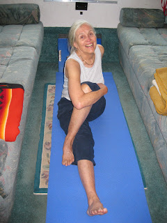
When we are traveling from one destination to another with a goal in mind, our casual routine is interrupted and often our exercise suffers.  So, I have learned to do a modified yoga routine between the coaches in the back of the RV. My music of choice now is Susan Boyles's I Dreamed a Dream.  Many would question this choice because exercise music usually has a loud strong beat.  However, I like Susan.

Her song Who I Was Born To Be is one of my favorites:

                          "And though I may not know the answers
                            I can finally say I'm free
                            If the questions led me here, then
                            I am who I was born to be."

A wonderful 94 year old friend of mine says it another way.....

                           "I am in the God place,
                            at the God time,
                            doing the God thing!"

Route Two to Tok

The Klune Mountain Range

After crossing the border into Alaska, one of the first entries in the Milepost is a warning written in red:
"Watch for gravel breaks, bumps, dips and chuckholes next 72 miles.  Slow for loose gravel!"
Somehow we thought the highway would improve as soon as we got back into the US .... how silly of us.
We did read that the Alaska Highway Permafrost Research Project, implemented in 2008, is monitoring the permafrost temperatures and testing various construction techniques in order ito improve the road conditions.  That's a promise for tomorrow, but for today we got to rock and roll..... for 72 more miles!

Chisana River, AK

In 1913 there was one more "flash in the pan" when gold was discovered in the Wrangell Mountains/Chisana River area. About 2000 stampeders came running only to be disappointed since just a few creeks had any gold.  This was the last major rush of the gold rush era, and lasted just over a year.


"Braided" sections of the Chisana River

Many of the rivers here are glacial rivers that are grey or white in color because of the silt they carry.  When the currants are slow they drop some of the glacial sediment, creating sandbars.  The rivers sculpt the land as they meander. They carve out new channels and abandon the old ones, creating a braided look.  This is always a work in progress.


When the road climbed higher we had good views overlooking the Chisana River Valley. There were miles and miles of  small lakes and muskeg (bogs). We passed the Tetlin National Wildlife Refuge which stretches over 730,000 acres.  It contains hundreds of small lakes and two glacial rivers, the Nabesna and the Chisana, which combine to form the Tanana River.  I was interested in the fact that the Tanana River (pronounced TAN-ah-nah) flows 440 miles northwest to join with the Yukon River.

It was fun to think that we were travelling along the route flown by hundreds of thousands of birds.  More than 115 bird species nest in this area, and some migrate from as far away as South America!

A Husky I met in Dyea..... he had hiked the Chilkoot Pass!

We finally reached Tok, which like many other towns in Alaska had its beginnings as a construction camp on the Alcon Highway in 1942. It is the only town in Alaska that travelers must pass through twice, so it serves them coming and going.  How it got its name, nobody really knows.  One theory is that it was once called Toyko Construction Camp and the name was patriotically shortened to Tok.  Another theory claims it was named after a husky pup. 

Tok is known as the "Sled Dog Capital of Alaska" because so many of its residents are involved in some way with dogs and dog mushing.  I learned that dog mushing is Alaska's official state sport. There is a well-known dog mushing trail in Tok which runs along the Alaska Highway for many miles so people can easily watch the races.The races start in November and extend until the end of March.  I'd love to see one.... but who wants to be here in the winter?  Tok set a record low of -71 degrees in January 1965, and that's enough to scare me off.

Mother Nature's Mixed Bouquet....  Snag Lake, YT

There are many RV parks in town, and David and I checked out a few before selecting the Sourdough Campground because there we could get internet service.  We both spent hours trying to get caught up on our Blogs. For a break we joined the other campers for a night of live entertainment.  A local ensemble played old familiar country-western tunes and we were invited to sing along, which was fun.  The group included an older woman clogging and playing the washboard, and a man stumming a wash bucket! The music was followed by a sourdough pancake toss.  A free breakfast was awarded to anyone who could toss a pancake into the "buck-it".  Both of us gave it a try... and both of us missed.

The next morning we decided to eat in the cafe' and try out their famous sourdough pancakes even though we did have pay for them.  And pay we did.  The cost was $12.00 each for a breakfast buffet of limp pancakes, canned fruit, reindeer sausage and biscuits and gravy.  The saving grace was that the coffee was good.  On our limited budget we did not like spending so much money for a mediocre meal.  Next time we will check out the buffet before we pay.

Tuesday, July 13, 2010

Haines Junction to the Alaskan Border.


We took the Alaska Highway out of Haines Junction, heading north.  It was an overcast day, but we still got glimpses of the mountain peaks in the Kluane Range.  Somewhere around Bear Creek Summit, 3,294 feet, we spotted two young black bears running out of the woods and we stopped and watched as they crossed the road behind us.  They were very nonchalant as they strolled across the highway. They must know that the traffic will stop for them. 

Kluane Lake, YT

The highway took us past many beautiful lakes and creeks and eventually we came to the viewpoint overlooking Kluane Lake's Horseshoe Bay, at the southern end of the lake. We drove along it's western shore for a long time.  This is the largest lake in the Yukon Territory and covers approximately 154 square miles. For about half the distance along the lake we enjoyed new highway.  Then, at Destruction Bay things changed and we started experiencing the infamous frost heaves of the Alaska Highway.  You can read about it, and hear about it, but you have to drive it to believe it. It was tricky driving even at 20-30 mph!


Lake Creek Yukon Government Campground

After just so many miles, David had to get off the highway, so he turned into Lake Creek Campground.  What a relief to stop and be still.  That night the temperature dropped to the low 30's and we had to put on an extra blanket to keep warm.  In the morning we were happy to have our dependable furnace.  We turn it on and then crawl back under the covers until the RV warms up enough to get up and fix a cup of coffee.

Pickhandle Lake, YT

That morning there was snow in the creek beds and a nip in the air, but the sun was up and we were ready to take on the highway again.  About five minutes out of camp plans changed, and we stopped at Pickhandle Lake which is right beside the highway. The Milepost says that there is good fishing there, so David had to try his luck.  The fish were jumping and he was tempted to put his Pack Canoe in the water.  However, there were so many cars pulling in to look around and take photos that we decided to move on and hopefully find a more private lake.  There were two trumpeter swans in the lake that would have been fun to paddle to... but.... next time maybe.

There were informative panals at Pickhandle Lake that explained that for thousands of years this lake was a trading place for several First Nations People.  Trade networks linked people from the coast with people from the interior.  Fish oil and European goods from the coast were traded for furs, birch bark and copper from the interior.  It is hard to imagine how the first Nation People moved through this rugged land without a vehicle or even a road. 

The Elders say, "To survive we had to travel".  So the Kluane and the White River people walked or snow-shoed, often using dogs to pack their goods before prospectors introduced horses in the 1890's.  The Alaska Highway that we are travelling on was not cut through until the 1940's... so who am I to complain about the ruts and potholes?


The weather had changed, but the condition of the highway hadn't.  The damaged roads were often marked by signs or orange flags, but not always. When the center line looked like ribbons fluttering in the wind and there were skid marks on the pavement, I knew to slow down!  The driving was stressful, so we decided to made this another short day. 

This time we pulled in  Snag Junction Yukon government campground. Snag is now an abandoned airfield and Indian village, whose claim to fame is the lowest recorded temperature in Canada, -81.4 on February 3, 1947!  For us, Snag Junction was a much needed break from driving.  We found a campsite right next to Snag Lake, and settled in.


There is nothing quite as relaxing as a quiet paddle on a small lake.  David and I slowly paddled all along the shore line and were rewarded by two trumpter swans flying right over our heads. We let the evening enfold us and wash away the stress of the highway.

Snag Lake, YT

The next morning we were elated to see signs for the Alaska border crossing.  When we got there we were the 7th vehicle in a slow moving line for customs, but that was OK.  The guy in front of us, driving the old school bus, shared his humor with us.... and we couldn't help but smile.


Alaska again..... and this time we were ready for her, or we thought we were.

The Haines Highway - A National Scenic Byway

Forget-Me-Nots ... Alaska's State Flower

The Haines Highway connects Haines with Haines Junction and the Alaska Highway. It is a 146-mile highway that starts in Alaska, goes through British Columbia and ends up in the Yukon! The highway skirts mountain ranges all along the way, as you pass the Takhinsha Mountains (AK), the Tatshenshini-Alsek Wilderness Provincial Park  (BC) and the Kluane National Park Reserve (YT). There are breathtaking views of glaciated mountains as well as a variety of scenery from coastal forests to alpine tundra.

The Milepost  explains that "part of what is now the Haines Highway was originally a "grease trail" used by coastal Chilkat Indians trading eulachon oil (from Hooligan fish) for furs from the interior.  In the late 1880's the old trading route became a packhorse trail leading to the Klondike gold fields.  The present road was built in 1943 as a military access highway during WWII."


From Haines we drove north along the Chilkat and Klehini Rivers.  As we drove we saw two fish wheels on the river.  They looked like wire water wheels to me, as they scooped up the fish and dropped them into the boat as the wheels turned.

The highway started climbing as we entered British Columbia and skirted the Tatshenshinhi-Alsek Wilderness Provincial Park. Along that stretch we saw pairs of trumpeter swans in many of the small lakes, and even spotted one pair nesting on top of a beaver lodge, as they often do.

And finally, we got a look at a grizzly bear.  The bear was on David's side of the car, so he got better pictures, but just seeing the bear was a thrill.

Three Guardsmen Mountain - 6,3000 ft.

As the road climbed higher we passed the Three Guardsmen Mountain. There was cloud cover, but the peaks were still impressive.  Higher still, we went over the Chilkat Pass at 3,510 feet and then meandered through a wide alpine valley.  There was ice on the small ponds, and the snow covered peaks looked like giant frozen waves.


In The Milepost I read that "The Chilkat Pass was one of the few mountain passes offering access into the Yukon from the coast.  The Chilkat and the Chilkoot Passes were tenaciously guarded by Tlingit Indians.  These southern Yukon Indians did not want their lucrative fur-trading business with the coastal Indians and the Russians jeopardized by white strangers. However, the gold rush of 1898 brought thousands of white people inland and finally opened the Chilkat Pass, forever altering the lifestyle of the Interior Natives."


We pulled over in a rest area for lunch.  We were surrounded by tundra and had to wonder where all the caribou were! It looked like caribou and reindeer country to us.

From there the highway descended toward Haines Junction, following the course of the Tatshenshini River. We passed into the Yukon Territory before we stopped for the night at the Million Dollar Falls Yukon Government Campground.  There were 34 sites there, but only one other was taken.  Many people drove in to view the falls, but they did not stay. A boardwalk trail and viewing platforms allow you to look down on the Takhanne River.  This is another good fishing river, but it was too high and fast to tempt David.


Million Dollar Falls, on the Takhanne River, YT

Just two miles beyond our campground we stopped at a large rest area to get photos of our first look at the  Kluane Range ( pronounced kloo-WA-nee).  This range of mountains parallels the highway from here to Haines Junction, giving us a nearly unbroken chain of mountains.  The mountains are up to 8,000 feet tall and interrupted only by a few large valleys cut by glacier-fed streams.  The mountains' snowy tops were brilliant white against the blue sky.

The Kluane Mountain Range in the YT

From there, the trip was one continual feast for the eyes.  The clouds and the sun seemed to take turns enveloping the mountain tops and giving us one of Mother Nature's best light shows. It is no wonder that these 146 miles have been designated a National Scenic Byway. 

Looking back, neither David nor I have much recollection of the village of Haines Junction.  We remember it as the junction with the Alaska Highway and where we filled up the gas tank.  This town was established in 1942 during the construction of the Alaska Highway, and now basically offers services to travellers. My impression was of a town sprawling out around the junction, and briefly obscuring the majestic views into Kluane National Park....   or perhaps briefly obscuring my awareness of the majestic views...

It is amazing how quickly our so-called civilization can blot out the beauty of the natural world.